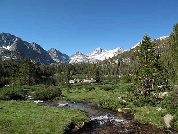
Little Lakes Valley
Difficulty:
Distance:
Elevation:
Time:
Easy
Varies
Varies
Varies
Little Lakes Valley is one of the most scenic and popular hikes in the eastern Sierra. Mosquito Flat trailhead, the highest in the Sierra, offers easy access to a spectacular backcountry region rimmed by 13,000' peaks. After a small elevation gain (a few hundred feet) within the first half mile, the trail is mostly level as it traverses the valley, passing several picturesque lakes. At the far end of the valley the trail begins to climb once again to Morgan Pass and Gem Lakes.
The round trip distance to Gem Lakes is approximately 7 miles, but any length hike along this trail makes for an enjoyable outing. The first of a series of lakes is encountered within approximately 1/2 mile from the trailhead. From this point the trail is essentially level to Long Lake at the end of the valley. Be sure to bring a camera as there are numerous photo opportunities at every point along this trail.
If the scenic beauty along this trail isn't sufficient, an added bonus awaits at the end of a morning hike .. slices of wonderful, fresh baked pies at the Pie in the Sky Cafe at Rock Creek Lodge .. a favorite stop well-known by most locals. (You passed Rock Creek Lodge on your right on the way up to the trailhead. Look for the Cafe about 4 miles from Mosquito Flat on your way back down to the 395).
The following links provide additional information about hiking in Little Lakes Valley -